


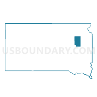
VTD-precinct 4, Clark County, South Dakota
About
Outline

Summary
| Unique Area Identifier | 667124 |
| Name | VTD-precinct 4 |
| County | Clark County |
| State | South Dakota |
| Area (square miles) | 107.63 |
| Land Area (square miles) | 105.35 |
| Water Area (square miles) | 2.28 |
| % of Land Area | 97.88 |
| % of Water Area | 2.12 |
| Latitude of the Internal Point | 44.98552130 |
| Longtitude of the Internal Point | -97.60597470 |
Maps


Graphs
Select a template below for downloading or customizing gragh for VTD-precinct 4, Clark County, South Dakota


Neighbors
Neighoring Voting District (by Name) Neighboring Voting District on the Map
- VTD precinct Eden and Phillips, Codington County, SD
- VTD precinct Graceland and Henry, Codington County, SD
- VTD-precinct 1, Clark County, SD
- VTD-precinct 2, Clark County, SD
- VTD-precinct 5, Clark County, SD
- VTD-precinct 6, Clark County, SD
Top 10 Neighboring County Subdivision (by Population) Neighboring County Subdivision on the Map
- Mount Pleasant township, Clark County, SD (270)
- Graceland township, Codington County, SD (105)
- Eden township, Codington County, SD (98)
- Elrod township, Clark County, SD (90)
- Day township, Clark County, SD (85)
- Cottonwood township, Clark County, SD (84)
- Phipps township, Codington County, SD (75)
- Woodland township, Clark County, SD (63)
- Garfield township, Clark County, SD (60)
- Eden township, Clark County, SD (59)
Top 10 Neighboring Place (by Population) Neighboring Place on the Map
Top 10 Neighboring Unified School District (by Population) Neighboring Unified School District on the Map
- Webster School District 18-4, SD (3,038)
- Clark School District 12-2, SD (2,566)
- Florence School District 14-1, SD (836)
- Henry School District 14-2, SD (534)